
Services
Drone photogrammetry and LiDAR
We use drone technology, photogrammetry and LiDAR scanning to capture detailed site data quickly and accurately. We produce orthophotos, point clouds, digital terrain models and 3D models that support project design, planning and progress monitoring.
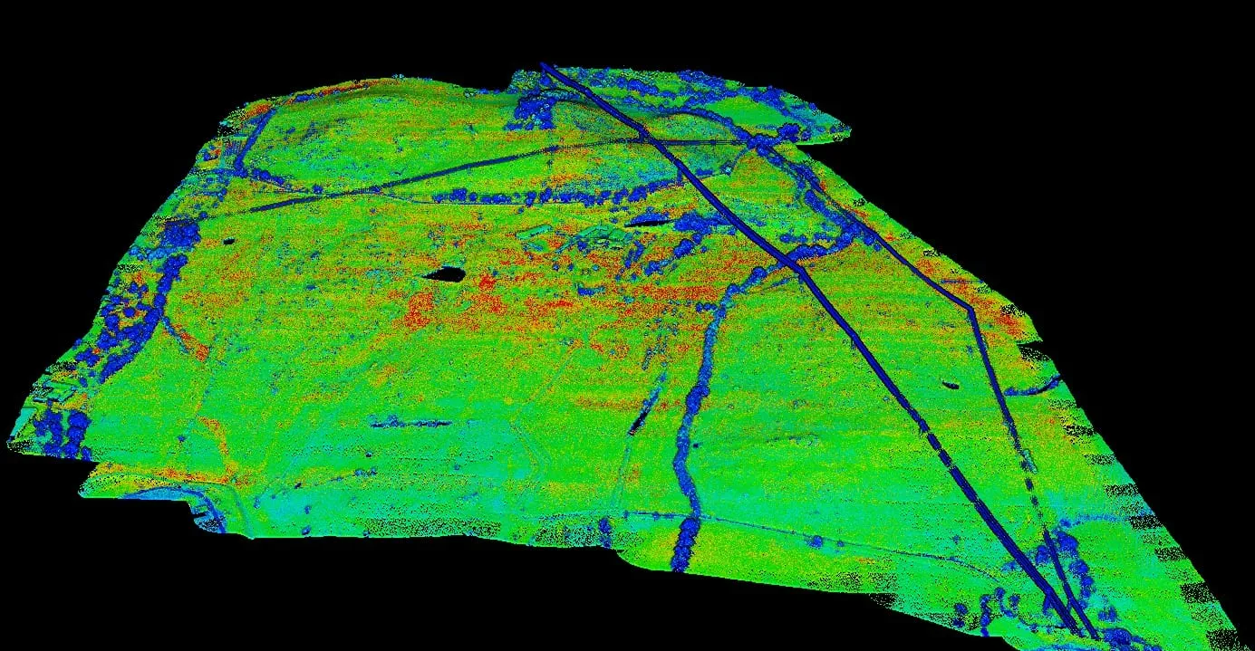
Drone LiDAR and photogrammetry capture large solar and BESS sites much faster than a ground-only survey. LiDAR reaches the ground beneath vegetation to model the bare terrain, while photogrammetry produces sharp, georeferenced orthomosaics for planning and progress tracking.
Every flight is tied to ground control measured with RTK GNSS. We process, classify and check the data before delivery, so your team receives point clouds, terrain models and orthomosaics ready to use in CAD and GIS.
What it includes
- Flight and ground control planning.
- LiDAR and photogrammetric data capture.
- Ground control points measured with RTK GNSS.
- Processing, point cloud classification and QA/QC.
- Delivery in your engineering team's formats.
Deliverables
- Classified point cloud
- LAS / LAZ
- Georeferenced orthomosaic
- GeoTIFF / ECW
- DTM, DSM and contour lines
- GeoTIFF / DWG / DXF
- Volume reports
- PDF / XLSX
Project types
- Solar and BESS feasibility and design studies.
- Earthwork and stockpile volume calculations.
- Construction progress monitoring.
- As-built documentation.
- Wind farms, roads and power lines.
Equipment
- LiDAR-equipped drone.
- Photogrammetric camera.
- RTK GNSS for ground control.
- Processing and classification software.
How we work
- 01
Goal
Tell us what you need the data for: design, volumes or progress tracking.
- 02
Flight plan
We choose the sensor, density, ground control and flight dates, in line with airspace rules.
- 03
Capture
Drone flights and ground control measured with RTK GNSS.
- 04
Processing and delivery
Classified, checked data in your formats.
FAQ
LiDAR or photogrammetry?
If there is vegetation, or you need the bare ground underneath it, LiDAR. For orthophotos and progress monitoring, photogrammetry is usually enough. We'll recommend the right option for your goal.
How much area can you cover in a day?
It depends on the terrain, the required density and local flight regulations. We'll set it out in the quote.
Can you fly the same site repeatedly to track progress?
Yes. We repeat flights with the same ground control and settings, so results are comparable from one campaign to the next.
Is the data ready for CAD and GIS?
Yes. We deliver point clouds, surfaces and orthomosaics in standard formats and in the coordinate system of your project.